You are here

Map

One Concern Uses AI to Streamline Disaster Relief Efforts


Image: One Concern

fastcompany.com - by Katharine Schwab - November 15, 2018

 . . . One Concern is launching a machine learning platform that provides cities with specialized maps to help emergency crews decide where to focus their efforts in a flood. The maps update in real-time based on data about where water is flowing to estimate where people need help the most. It’s the latest in a wave of AI-powered tools aimed at helping cities prepare for an era of severe, and increasingly frequent, disasters.

(CLICK HERE - READ COMPLETE ARTICLE)

---------------------------------------------------------

Our platform provides unprecedented situational awareness and actionable insights for decision-makers.

Country / Region Tags: 
Problem, Solution, SitRep, or ?: 

Tropical Storm Jose - Tropical-Storm-Force Winds Probability

Current predicted probability of tropical-storm-force winds from Tropical Storm Jose.

Image: Current predicted probability of tropical-storm-force winds from Tropical Storm Jose.

nhc.noaa.gov - September 15th 2017

Note: The time of the tropical cyclone's center location at the bottom of the graphic will be 3 hours earlier than the time of the current advisory. The forecast cycle for each advisory begins 3 hours prior to the issuance of the advisory products.

(VIEW COMPLETE WEBPAGE)

Problem, Solution, SitRep, or ?: 

What Happens If a Nuclear Bomb Goes Off in Manhattan?

Manhatten skyline. Lucas Jackson / Reuters

Image: Manhatten skyline. Lucas Jackson / Reuters

theatlantic.com - March 15th 2017 - Kaveh Waddell

On a quiet afternoon, two medium-sized nuclear blasts level portions of Manhattan.

If this were a movie, hordes of panicked New Yorkers would pour out into the streets, running around and calling out for their loved ones. But reality doesn’t usually line up with Hollywood’s vision of a disaster scene, says William Kennedy, a professor in the Center for Social Complexity at George Mason University. 

(VIEW COMPLETE ARTICLE)

Country / Region Tags: 
Problem, Solution, SitRep, or ?: 

How citizen scientists use the web to track the natural world

A screenshot of the Frog Watch map.
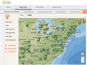
Image: A screenshot of the Frog Watch map.

greenbiz.com - July 8th, 2014 - Yale Environment 360

By making the recording and sharing of environmental data easier than ever, web-based technology has fostered the rapid growth of so-called citizen scientists — volunteers who collaborate with scientists to collect and interpret data. Numerous Internet-based projects now make use of citizen scientists to monitor environmental health and to track sensitive plant and wildlife populations. From counting butterflies, frogs, and bats across the globe, to piloting personal drones capable of high-definition infrared imaging, citizen scientists are playing a crucial role in collecting data that will help researchers understand the environment. Here is a sampling of some of these projects.

(VIEW COMPLETE ARTICLE)

Country / Region Tags: 
General Topic Tags: 
Problem, Solution, SitRep, or ?: 

NY District Coastal Storm Risk Reduction Projects and Studies Map

                                            (CLICK ON THE MAP IMAGE BELOW TO ENLARGE)


nan.usace.army.mil

Click the names of projects and studies in the link below to learn more about them

http://www.nan.usace.army.mil/About/Hurricane_Sandy/CoastalStormRiskReductionProjectsandStudies.aspx

Country / Region Tags: 
Problem, Solution, SitRep, or ?: 

Fed Flood Maps Left NY Unprepared for Sandy — and FEMA Knew It

Flooding in Red Hook, Brooklyn after Sandy (Flickr/gunnicool)

The agency ignored state and city officials' appeals to update the maps with better data until it was too late.

wnyc.org - December 6, 2013
by Al Shaw : ProPublica / Theodoric Meyer : ProPublica / Christie Thompson : ProPublica

When Patrice and Philip Morgan bought a house near the ocean in Brooklyn, they were not particularly worried about the threat of flooding.

Federal maps showed their home was outside the area at a high risk of flood damage. . .

. . . But the maps drawn up by the Federal Emergency Management Agency were wrong. And government officials knew it.

(READ COMPLETE ARTICLE)

Country / Region Tags: 
Problem, Solution, SitRep, or ?: 

Reworking New York's Flood Map Post-Hurricane Sandy


The new map could put twice as many homes in the flood zone and raise premiums for many homeowners.

propublica.org - by Al Shaw - June 12, 2013

. . . while Sandy’s water has long receded and the bulldozers have left, a residual effect for homeowners along the city’s coastline still lurks quietly beneath the surface. It comes in the form of a July 2012 law called the Biggert-Waters Act, which will end subsidized rates for property owners who are remapped into more severe flood zones, increasing their flood insurance premiums 20 percent a year until they reach market rates, and will apply those higher rates for newly purchased property.

The potential increases, which proponents say are necessary to sustain the National Flood Insurance Program, are not widely understood by residents, and may be catching them unprepared.

(READ COMPLETE ARTICLE)

Biggert-Waters Act - Flood Insurance Reform Act of 2012

Country / Region Tags: 
General Topic Tags: 
Problem, Solution, SitRep, or ?: 

These Interactive Maps Compare 19th Century American Cities to Today

As mind-blowing as science is these days, it's probably safe to say that we're not going to invent a time machine within the next century. Through the magic of code, though, there is an entertaining alternative in the world of interactive maps. Obviously, The Smithsonian is on it.

The magazine recently dipped into David Rumsey's collection of over 150,000 maps to find some of the best representations of American cities over the past couple hundred years. With some simple programming, they were able to overlay images of vintage maps of some major cities onto satellite images from today. The results are fascinating.

See maps of New York City, Denver, Los Angeles, San Francisco, Denver, and Washington, DC

Country / Region Tags: 
General Topic Tags: 
Problem, Solution, SitRep, or ?: 

Pages

Subscribe to Map
howdy folks