
User login
Language
Anonymous's groups in this site
User is not a member of any group.
Your groups across all your sites
User is not a member of any group.
Recent Content
Who's online
There are currently 0 users online.
You are here
Fri, 2012-11-23 17:20 — Kathy Gilbeaux
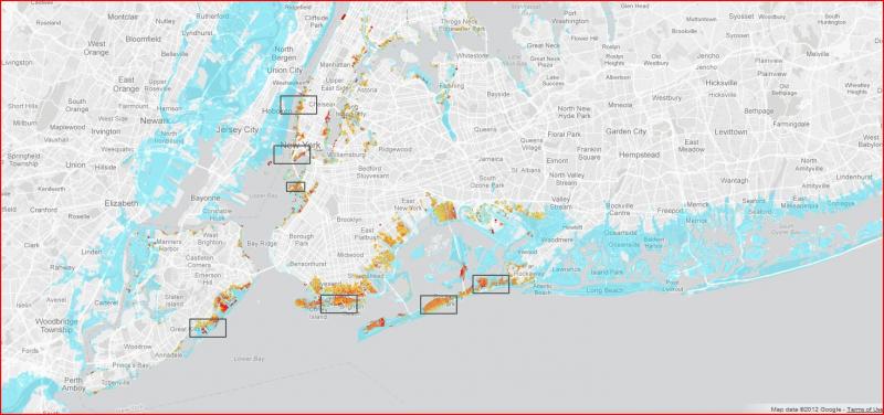
nytimes.com - By MATTHEW BLOCH, ALAN McLEAN and ARCHIE TSE; reporting contributed by Joseph Berger, Cara Buckley, Sarah Maslin Nir, Kirk Semple and Vivian Yee Sources: Flood areas and levels from the Federal Emergency Management Agency; Andrew A. Beveridge, socialexplorer.com; building shapes from NYC Open Data
In the days before the arrival of Hurricane Sandy, few people in New York City anticipated the scale of destruction of the storm. The map shows the estimated height reached by floodwaters, which topped 17 feet in some parts, according to surveys and weather data collected by the Federal Emergency Management Agency.
Groups this Group Post belongs to:


Recent Comments