
User login
Language
Anonymous's groups in this site
User is not a member of any group.
Your groups across all your sites
User is not a member of any group.
Recent Content
Recent Comments
- USDA faulted for disclosing scant information about bird flu 2 days 23 hours ago
- United Health advancec over $2 billion to hacking victims 1 month 1 week ago
- Charts show how flu, COVID and RSV have spread in the U.S. 1 month 1 week ago
- Congressional funding resources cutbacks likely 2 months 3 weeks ago
Who's online
There is currently 1 user online.
- mike kraft
You are here
Thu, 2012-11-01 12:11 — admin
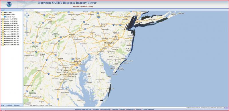
NOAA’s National Geodetic Survey's remote sensing program conducts aerial photographic surveys the coast to document coastal damage and impacts to navigation.
The data contained in these photos provide emergency and coastal managers with the information they need to develop recovery strategies, facilitate search-and-rescue efforts, identify hazards to navigation and HAZMAT spills, locate errant vessels, and provide documentation necessary for damage assessment through the comparison of before-and-after imagery.
Groups this Group Post belongs to:


Comments
Election poll sites relocated
http://www.ny1.com/content/top_stories/171796/election-poll-sites-relocated-due-to-sandy-damage